
This is the road to the Scales Campground on Mt Rogers. It takes around 45 minutes to go the 3.5 miles to the campground. It's one lane, and you may need to back up to find a spot wide enough to allow another vehicle to pass. There appear to be 3-4 dispersed campsites on this road. One is close to a waterfall. FSR 613 Most trucks and SUVs can easily do this road without 4WD. Horseback riders and hikers also use the road. I was told ATVs are not allowed.
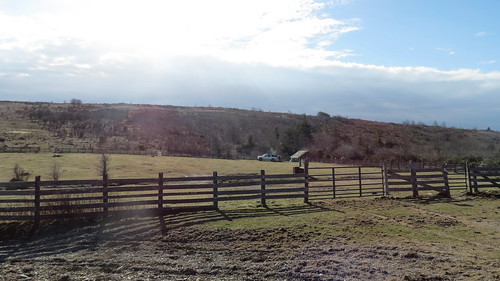
When I took this picture, I had descended the AT (Appalachian Trail) facing Scales Campground on Pine Mountain in the Mt. Rogers area. It is really just the open field you see in the picture. To get to this point with 4WD, you go through two fences. We camped in the far corner (see the Suburban) which I recommend due to the number of AT and day hikers that cross this field. There are approximately 20-25 campfire rings in this field. There are two vault toilets. There was plenty of firewood to pick up as the forestry department had been cutting down some of the trees and brush. This is a free dispersed camping area.
If you camp here, take extra TP because the AT hikers take it out of the bathrooms. I refilled it twice in one day, and they took all of it. I didn't mind..expected it and planned for it. I also took extra water and snacks to offer the hikers to foster better relationships between them and the 4WD community. We do both hiking and off-roading, so we hear both sides. Most were very grateful.
One hiker bit my head off at my offer of water or snacks with "NO! I DO NOT!!!" and then quickly changed his tone and sheepishly thanked me. Others used the offer to ask us questions, get directions, or just talk. 99% of our encounters were positive.
One hiker was very rude to us because she didn't like our suburban being there, but she was ignorant of the road use. We checked with the forestry service before we went. Vehicles are allowed. We just stayed polite until she took herself and her attitude away. She never thanked me for providing her or her embarrassed friend with toilet paper. We saw 4-5 other off-roaders in the campground and a few more on Rt 613. One retired military Jeeper came to make himself coffee and breakfast over a campfire and watch the sunrise. Then he left.
A long time ago, livestock was raised in this area because they would grow nice and fat on the pasture there. The road was so rough that the animals would lose significant weight on the trip down the rugged mountain trail resulting in less money. The farmers started selling the livestock in the field to get top dollar. They call it Scales because that is where they had the scales to weigh the animals before the sales.
The ponies were put there to keep the area cleared. The ponies never came to the fence, but we hiked into their area and found them. We saw someone (rangers?) on a quad feeding them hay daily just up the ridge. This is another managed herd like you will see in Chincoteague and Corolla.
It's very quiet. I fell asleep in the sun...twice. There were many songbirds singing and pretty views. The views are even better if you climb the trail to the ridge. The stars shone so brightly and the air was so sweet. We saw several falling stars while here too. On the road that connects to 613 are at least three campgrounds where you pay a small fee in an envelope when you arrive. They offer the same deal...vault toilet, no water, no power.

This hiker was so excited to see us! He wanted to know how to get to the Scales by 4WD. He has family he wants to share this area with but they have special needs and are not able to hike into a forest. Clint helped him plan his route, understand what he'd face on the road, and know what he'd need to bring. He showed him where he could get cell phone reception in case of emergency. Now, this man's family can go into the forest and experience nature according to their abilities. THIS is why I think it is important we work to keep as much access to our public lands as possible so all of us can enjoy them.